It still feels surreal to say that I stood at the summit of the Philippines’ highest mountain. Three days later, my thigh muscles are still sore; the summit, trails and views are still vivid in my mind but ironically it feels like such a distant memory. The people I spent 3 days and 2 nights with were strangers to me then and now I may actually have a bad case of separation anxiety.
Day 0
We flew from Manila to Davao and spent the night at Ponce Suite in the city. I met the entire group for the first time since we were incomplete during the pre-climb meetings. There were 9 of us, including a Kiwi couple. I also had to repack my things and roll them into Ziplock bags to waterproof and make more space in the bag for common materials. I used to swear that the backpack was part of the experience, but I figured 3 days would be too much for my back so I’ve decided to hire a porter.
Day 1
We left the hotel at 6 am, grabbed some breakfast then headed to Digos, a 2-hour van ride away from the city. The entire group had to secure medical certificates, waivers, IDs and other documents first, and then we headed to the town market. From here, it was a bumpy truck ride to the jump off, and the trek finally commenced at around 12.30pm. It had been drizzling the past few days according to the locals, and the sky was a bit gloomy when we started. This is it! No turning back now.
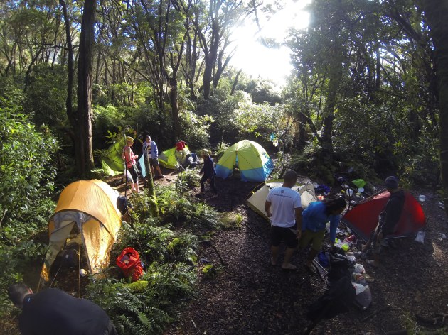
We passed farmlands and small communities (Sitio Paradise) before entering a mossy forest. The Kapatagan trail is supposedly easy, although it was muddy and had a lot of ascents. Maybe I was just not fit enough, since I only started training three weeks prior… that is if you count 3-km runs twice a week as training. Haha! Darkness eventually caught up with us; we had to slow down and use each other’s headlamps to light our path to the first campsite, Godi Godi peak.
A bowl of spicy tuna pasta and a bottle of brandy later, our socials night was cut because the rain began to pour. I hardly had decent sleep because it was just too cold. The morning felt much better though as the sunshine warmed us all up.
Day 2
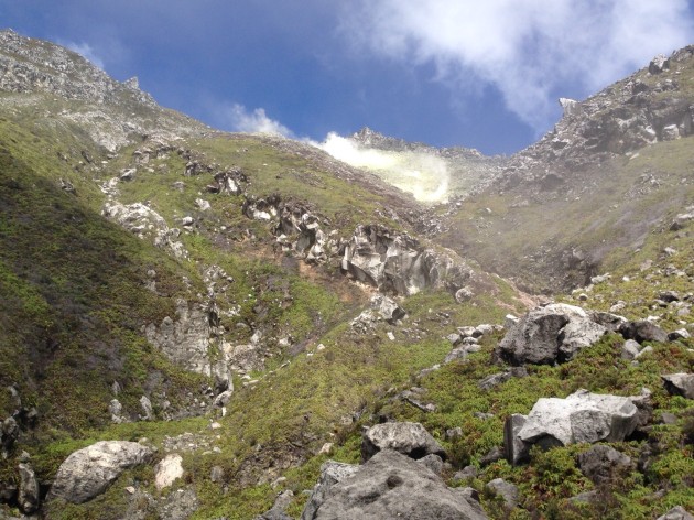
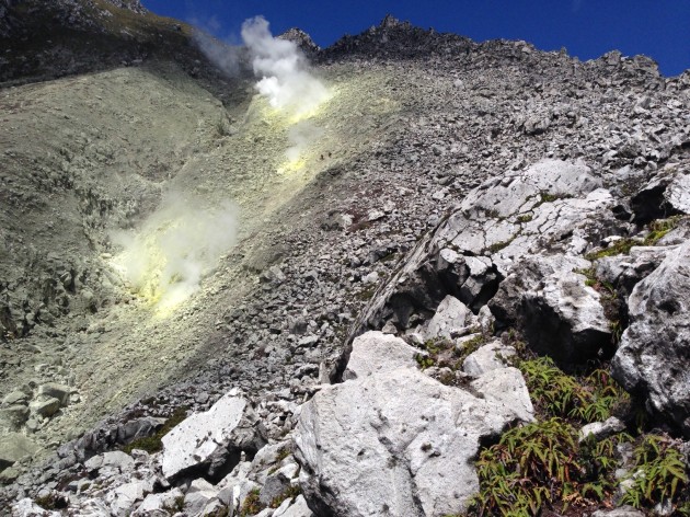
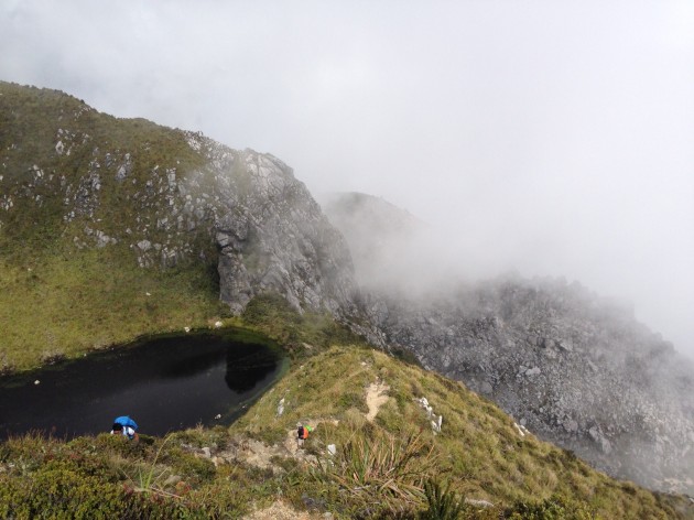
After breaking camp in Godi Godi, we headed for the boulders. This trail is unique to Apo and it was just beautiful in a rugged, rough kind of way. It can be seen clearly from afar, and it looked more unreal as we came closer. It had no definite trail; we chose our own paths as long as we ended up where we were supposed to be. Sulfuric vents scattered in the area released steam that smelled of rotten eggs. The boulders were huge and stable, but there were also gaps and loose rocks along the way. It was a steep climb that took around 3 hours (including photo ops, of course 🙂 ), and thankfully weather was good and bearable.
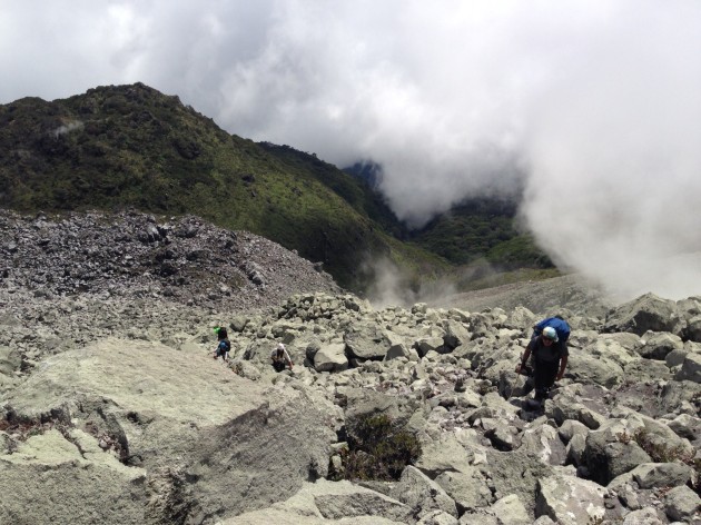
Near the top, we took a left turn and ended up in an emergency camp area called Boracay, named after the famous island for its white sand. We stopped to take lunch and prepare for a final 90-degree assault on more boulders. It was a scary thought, but there was really nowhere else to go. Hahaha!
Our reward was a much-needed water source. After that steep climb, we found ourselves in Apo’s dead crater.
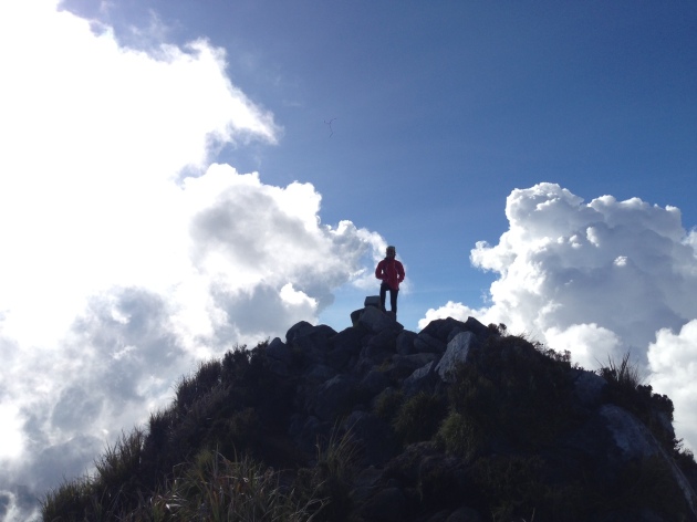
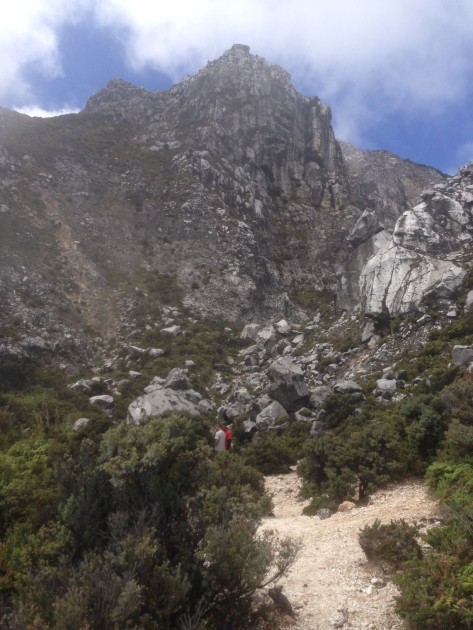
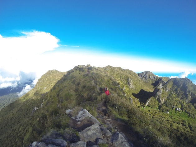
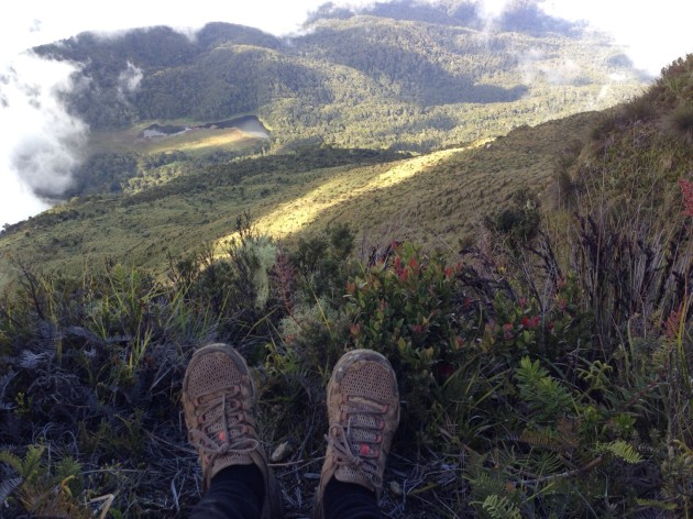
A few minutes past the crater, we reached our summit, Davao peak. There was no clearing when we arrived, but it felt so good to be up in the clouds! And that was not the end of it – we went down the other direction and headed for the more famous peak (Apo has 7), Kidapawan.
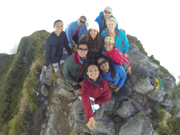
It was sheer happiness to be at the summit. All the fatigue and exhaustion were carried away by the wind and the clouds and the gorgeous view surrounding all 9 of us. We took our time snapping photos and just taking it all in.
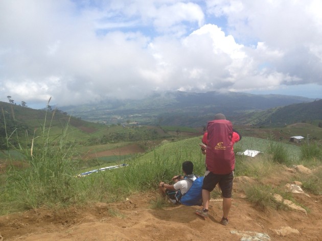
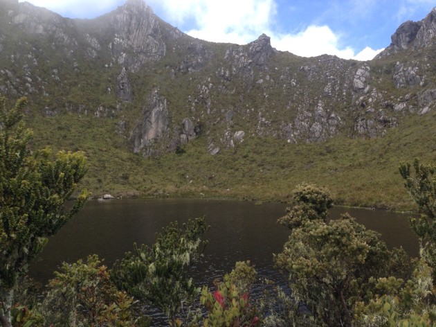
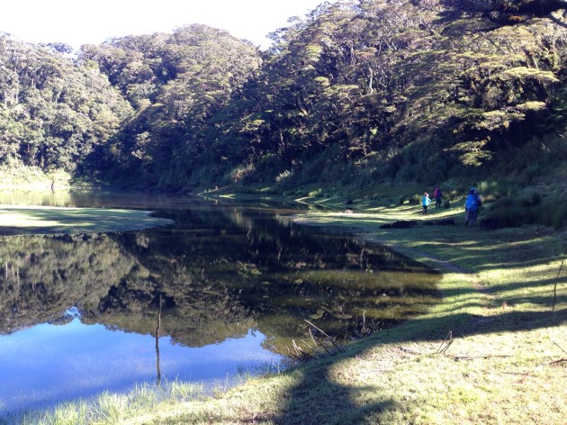
It took another 3 hours to get to our next destination – Lake Venado (above as seen from the summit), where we set up camp for the night. It was a wide open flat ground and we were the only ones in the area. We had another round of socials, a bonfire to warm the night and a clear view of the starry night sky. Life is good. 🙂
Day 3
Spent the entire day for our descent taking another route, the Sta. Cruz trail. I haven’t read much about this route, but it was a pretty established trail. We entered a mossy forest with a lot of fallen trees that also served as bridges, which was challenging because they were slippery and you couldn’t see what’s below! I’ve always found descents harder because they can be quite tough on the knees, and this trail was no exception. At the last stretch, I got blisters on both ankles but I kept going knowing it would hurt more if I had stopped. By this time, I just wanted to get it done with, remove my shoes and take a rest.
We reached the jump-off point around 4 pm, earlier than expected. The whole group celebrated with ice cold beer before heading back to Davao for our much-needed shower and sleep. This climb is definitely for the books!

Havent had a beautifully narrated (with images) climb in a long while. Although I cant feel your exhaustion. I wish we had selfie stick back in the days.
LikeLike
Haha I guess the feeling has worn off a bit. 🙂 but thank you! And yup, it was super helpful! Takes great shots in all angles too
LikeLike
Sounds like a amazing climb! Most of my hiking friends seldom describe their trips as “conquering the mountain” though 🙂
LikeLike
Nice! We haven’t climbed Mt. Apo yet, and we placed them at the back of our bucket list due to the trash and over-commercialization of the place. But when the climbing ban is lifted a few years from now, we’ll definitely make plans to climb Mt. Apo.
LikeLiked by 1 person